Last year we spoke about two atmospheric pressure systems, namely the Depression and the Anti-cyclone. This year we continue with systems which are basically derivatives of the first two:
- High pressure ridges. They are also known as “wedges”. It is an extension of an anti-cyclone and it could extend in any direction from its parent. Generically it is associated with fair anti-cyclone weather. If the curvature along the axis of a ridge is small, the ridge is known as a flat ridge and tends to move faster than one in which the curvature is great.

High pressure ridge.
- Low pressure trough. Also called a V-shaped depression, this is an extension of a depression into a high pressure area. It nearly always points towards the equator. The trough may be frontal, in which case there is a marked change in the direction of the isobars on the trough line, or non-frontal, where the isobars are well rounded. Frontal troughs may be associated with warm, cold, secondary cold or occluded fronts and the weather changes will be similar to those associated with these fronts.
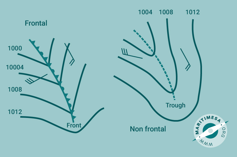
Low pressure trough.
- Col. When two anticyclone systems and two depression systems are diametrically opposed there is an area in the centre of the four systems which cannot be considered as a high pressure or a low pressure area. This area is known as a “col” and the pressure is lower than round the high pressures and higher than around the low pressures. In a col the pressure gradients are small, giving light variable winds. In general the relative humidity is high and there may be fog, or there may be thunderstorms.
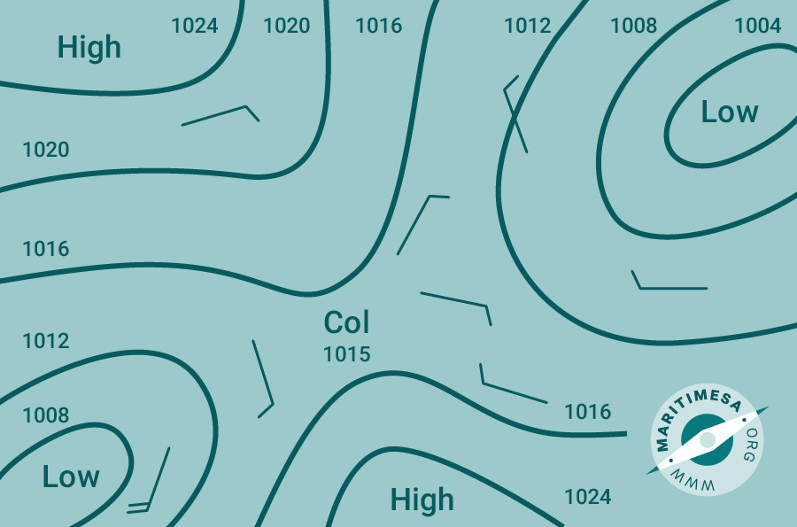
Col.