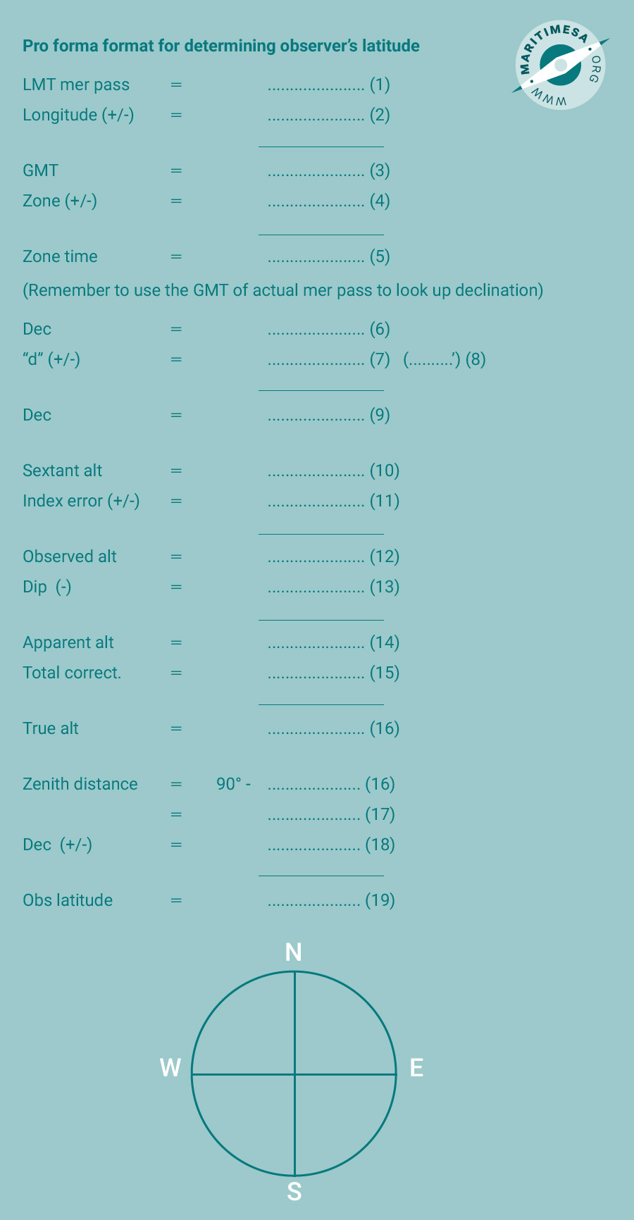
The procedure laid out below should be followed to find the latitude of the observer at meridian passage. A pro forma format for working the problem out is also provided and should be followed in conjunction with the procedure. A good navigator will start preparing for the midday sight an hour or two before the actual event. He will work out the probable time of mer pass and from that he will work out where he expects to be at mer pass. How does he do this?
First he will look up the LMT of mer pass in the nautical almanac. Using the LMT as zone time, he can work out his DR position at that time. He will then take the longitude of the DR position, convert it to time and apply it to the LMT in order to obtain an improved estimate of the GMT and zone time of mer pass.
If he is not on watch, he will come to the bridge approximately 10 minutes before mer pass is estimated to occur and prepare to take the sun’s altitude. Using the sextant, he will monitor the altitude of the sun, which will continue to increase until the sun is on the meridian. Immediately after this it will decrease. At the very moment it decreases, the navigator will record the time and the altitude. Using the data obtained he will work out the true altitude and the zenith distance of the sun and, from the time, the declination of the sun at mer pass.
Using the zenith distance and the declination he is now able to work out the latitude of the observer at mer pass.
The following is a step by step explanation of the procedure which must be read in conjunction with the pro forma format:
- Determine the LMT of mer pass from the nautical almanac and enter it on the form in position (1).
- Plot your DR position for the time of LMT (use LMT as the zone time) and read off your longitude.
- Convert the longitude to time (conversion of arc to time table) and enter it in position (2) on the form.
- Add or subtract the converted time from the LMT and enter it in position (3). If the longitude is east then the converted time is subtracted from the LMT in order to obtain the GMT. If it is west, then it is added. Remember to write the zone letter next to the result, ie Z.
- Work the time zone you are in and enter the figure in position (4).
- Add or subtract the zone to/from the GMT and enter the result in position (5). Remember to put the correct time zone letter next to the time.
- Approximately ten minutes before the zone time of mer pass go to the bridge and prepare to take an altitude of the sun with the sextant.
- Follow the sun’s movement with the sextant. When it reaches its maximum altitude, it will be on the observer’s meridian, ie at mer pass.
- Record the altitude and the exact time of max altitude.
- Enter the sextant altitude in position (10).
- Using the exact time of mer pass, convert it to GMT.
- Using this time, look up the declination for the hour in the nautical almanac and enter it in position (6).
- Obtain the average hourly change in declination from the bottom of the page in the nautical almanac (marked ‘d’)and enter it in position (8).
- Using the hourly difference and the minutes of the actual time (of mer pass), determine the ‘d’ correction from the appropriate tables at the back of the nautical almanac and enter it in position (7).
- Add or subtract the correction from the hourly declination (6) and enter it in position (9).
- Enter the index error of your sextant in position (11).
- Add or subtract the error from the sextant altitude (10) and enter the resultant observed altitude in position (12).
- Convert your height of eye (height above sea surface) to the Dip correction (table of dip corrections at the front of the nautical almanac) and enter it in position (13).
- Subtract the correction from the observed altitude and enter the resultant apparent altitude in position (14).
- Using the apparent altitude, look up the total correction in the appropriate table in the front of the nautical almanac and enter this in position (15).
- Add or subtract the total correction from the apparent altitude and enter it as the true altitude in position (16).
- Subtract the true altitude from 90° to obtain the zenith distance and enter it in position (17).
- Enter the declination obtained in (10) in position (18) and using the guidelines provided with the last drawing, determine the observer’s latitude. Write the observer’s latitude in position (19).

Pro forma format for determining observer’s latitude.

