When using the observation of heavenly bodies to determine geographical position, a “day’s work” for a navigator comprises five sets of astro sights (provided the weather is cooperative):
- During morning nautical twilight the navigator will take the sextant altitudes of at least three or four heavenly bodies and using this will be able to put a fix on the chart.
- During the day he has only one heavenly body available to him, namely the sun. As he would when he only has one terrestrial object to fix his position, the navigator makes use of a “running fix” to determine his position. He does this by taking three sights of the sun, one in the forenoon, one at meridian passage and one in the afternoon.
- During evening nautical twilight, he will again take sextant altitudes of at least three or four heavenly bodies and be able to put a fix on the chart.
Procedure for an astro running fix. The basic procedure for taking astro running fixes is as follows:
- Using the fix the navigator obtained from his observations during morning nautical twilight, he will determine and plot the DR position when he takes his mid morning sight of the sun. The mid morning sight will provide him with an intercept and bearing of the sun at that time and he will plot the resultant position line.
- His next step is to determine his DR position at meridian passage of the sun. This he will do as follows:
- Using the appropriate pages of the nautical almanac he will extract the LMT (local mean time) of meridian passage from the bottom of the right hand page.
- Using this time (LMT) as a first approximation of the zone time of meridian passage, he will determine his approximate DR position at meridian passage by subtracting the time of the mid morning sun sight from this time and multiplying it by his speed to give him the distance from the mid morning DR position.
- Using the longitude of this first approximation DR, he can convert the tabulated LMT of meridian passage to a more accurate zone time of meridian passage.
- The zone time obtained is then used to determine a more accurate DR for meridian passage. Again using the longitude of this (improved) DR position, he can refine the zone time of meridian passage.
- At the predicted time of meridian passage, the navigator will take the sextant altitude of the sun. Remember that the altitude of the sun will continue to increase until it reaches its zenith at meridian passage. As soon s the altitude drops, the time and the sextant altitude are noted. From the actual time of meridian passage and the sextant altitude, the observer’s latitude can now be determined and plotted near the DR position as a position line.
- As in the case of a terrestrial running fix, the intercept and position line obtained during the mid morning sight is transferred to the DR position at meridian passage. Where the transferred position line intersects the meridian passage passage position line, is the geographical position of the observer at meridian passage.
- From this position the vessel’s course is plotted. Using the vessel’s speed and the time between meridian passage and the time of the mid afternoon sun sight, the ship’s DR position at which the mid afternoon sight is taken is determined and plotted.
- Using the time, sextant altitude and the DR position, the intercept and bearing of the sun is calculated and the resultant position line is plotted.
- The position line obtained at mer pass is then transferred to the mid afternoon DR position. Where it intersects the latest position line is the afternoon geographical position.

Plotting running fixes obtained from the observation of the sun.

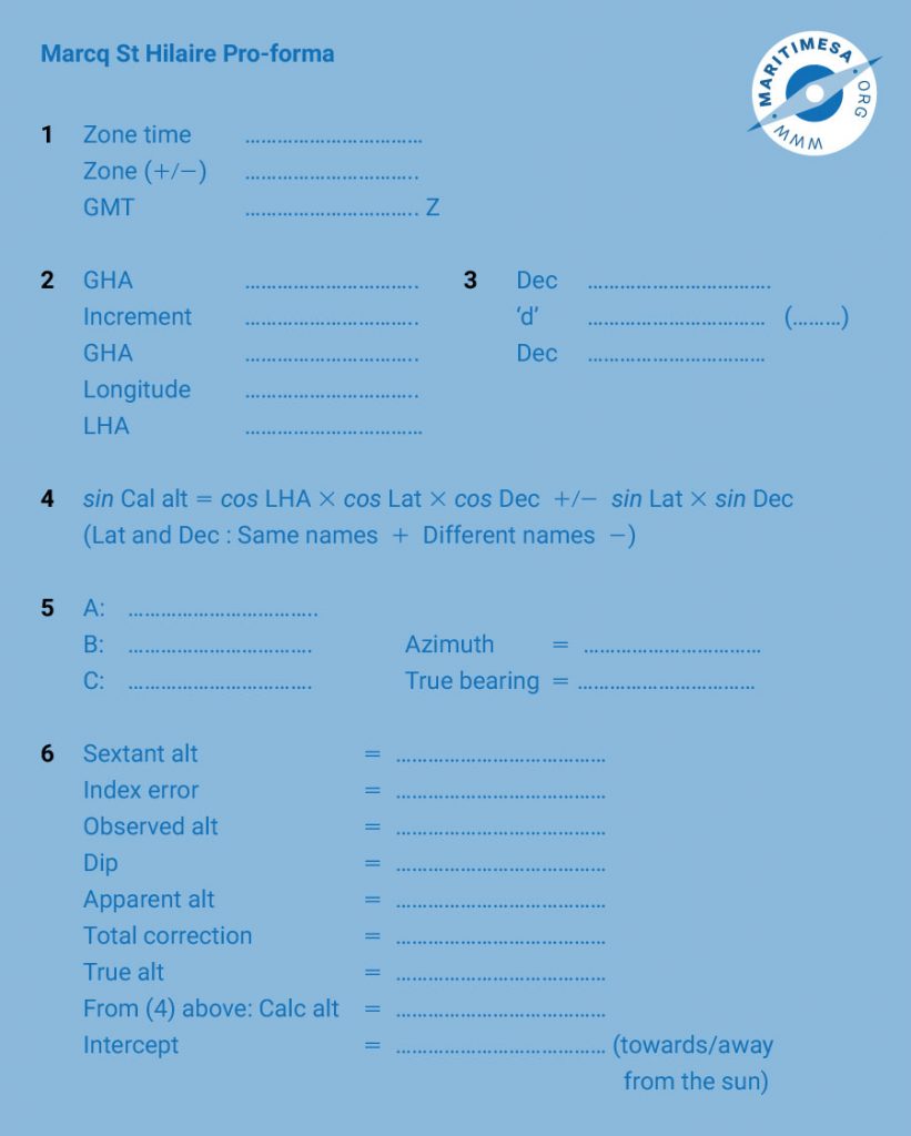
Marcq St Hilaire pro-forma.
The intercept is towards the sun if the true altitude is greater than the calculated one and away from the sun it is less than the calculated one.
Draw a sketch on the plane of the celestial horizon and show the following:
- The celestial equator.
- The declination of the sun.
- The position of the sun (X).
- The zenith position (Z).
- The elevated pole (P).
- The observer’s meridian.
- The prime vertical.
7. continued from the pro-forma above:
- Plot the DR position and the azimuth of the sun.
- Plot the position line at right angles to the direction of the intercept, bearing either towards or away from the sun at the intercept distance from the DR.


