The global positioning system utilises a constellation of 31 satellites orbiting the earth at very high altitudes. It was developed in 1973 and became operational in 1994. Initially only 24 satellites were used but in 2000 it was decided to upgrade the system to GPSIII. The system is owned by the United States of America who provided all the development work, the launching of the satellites and at present maintains the system. The initial cost was in the order of 10 billion US dollars. Although it was initially developed for the US military, it was made available for civilian and commercial use as well. The initial signal for civilian and commercial use was purposefully degraded to prevent an adversary using it for military purposes. In 2000 however, this was removed and the accuracy is the same for both military and civilians. The satellites are high enough to avoid the problems experienced by the land based systems and they use technology which provides pin point accuracy anywhere in the world, 24 hours a day. The accuracy for everyday use is within 20 metres. Not only can it be used for surface navigation but, because it can locate things in three dimensions, it can be used for aircraft (and missiles) as well.

Typical GPS marine display.
Concept (how does it work?).

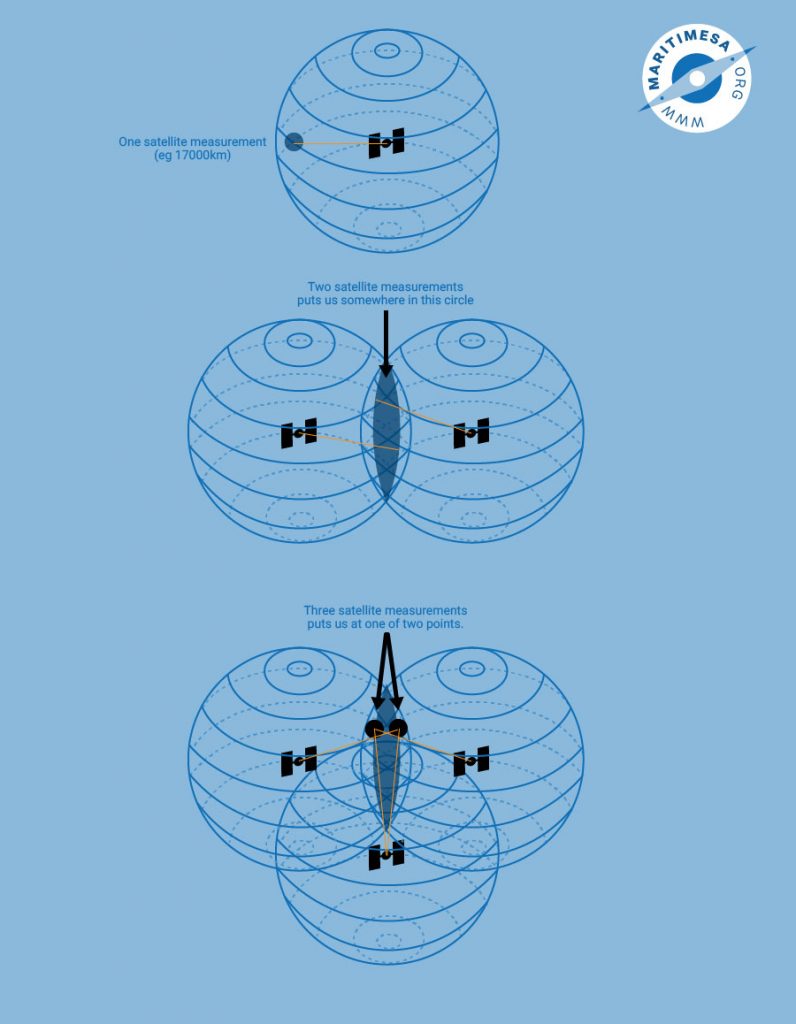
The principle behind the GPS system – each sphere represents the transmission coverage of a satellite.
Basically the user (navigator) measures the distance between the satellite and himself. If he only used one satellite this would provide him with a position anywhere on a sphere constructed around the satellite (ie. the satellite is in the centre). If he used two he would narrow his position down to a circle which would result from the intersection of the two spheres. Using a third satellite would narrow it down further to two positions which would result from the intersection of the third sphere with the circle produced by the first two satellites.. How do we know which of the two points is our position? Usually one of the two points produced is a ridiculous position and can be discarded. By using various techniques, the computer inside the GPS receiver can distinguish the correct position from the incorrect one.
Measurement of distance.
How do we measure the distance from the satellite? The GPS system measures the time a radio signal takes to travel from the satellite to the receiver. Since radio signals travel at the same speed as light (300 000 kilometres per second) all the receiver has to do is figure out exactly when the satellite transmitted its signal and measure the time it takes to reach it. This is done by installing very accurate clocks in both the satellites and the receivers and synchronising them. The clocks in the satellite are very sophisticated and extremely accurate and are also very expensive. Since it is not feasible from the cost point of view, to install the same type of clock in the ordinary GPS receiver, they are not as accurate as that in the satellites. In order to make up for the difference in accuracy between the satellites and the receivers, a technique is used to correct the errors caused by a lack of accurate synchronisation. This involves the use of data from a fourth satellite which provides a fix which the receiver realises is incorrect and through repeated correction/adjustment of the data from the four satellites is able to correct the error.
System overview.
- The space segment.

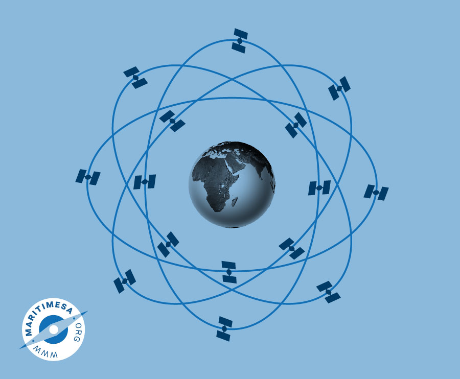
There are a total of 31 satellites (with two older deactivated satellites as ready spares) kept in 12 hour orbital planes. They are kept within one metre of their designated positions by the use of special onboard sensors and four hydrazine thrusters. The satellites are kept at an altitude of 20 200 kilometres. The orbits are chosen so that every satellite can be monitored and controlled by earth stations situated in United States territory. The orbital configuration of the satellite was designed so that at least four satellites with an elevation of greater than 9.5° will be in view of the receiving antennas at any point of the earth’s surface at any time. - The ground segment. The ground segment consists of the following:
- Master Control Station situated at Schriever Air Force base situated 25 km ESE of Colorado Springs.
- Four dedicated ground antennas situated at Kwajalein, Ascension Island, Diego Garcia and Cape Canaveral.
- Six dedicated monitoring stations situated at Hawaii, Ascension Island, Diego Garcia, Kwajalein, Colorado Springs and Cape Canaveral.
Satellite orbital parameters are constantly monitored by one or more of the ground tracking stations which pass the measured data to the MCS at Colorado Springs. From this data the MCS predicts future orbital data which is fed via the dedicated ground antennas to each satellite where it is stored in RAM and transmitted as a data frame to GPS receivers inside the coverage area of the satellite.


