Air masses are large areas of air having the same characteristics throughout. They may be either warm or cold, depending on whether their source is polar or tropical. They are also classified as either maritime or continental.
When two different air masses meet they form a boundary which is known as a front. Fronts are usually in motion, but if a front is stationary, it is referred to as quasi-stationary. When the approaching air is colder than the present air the boundary will be referred to as a cold front. If the approaching air is warmer than the present, the boundary is called a warm front.
The boundary between polar and tropical air masses is known as a polar front. Since polar air is more dense than tropical air, the former undercuts the latter causing it to rise. The surface of the front is therefore not vertical but inclined towards the colder. The slope of the cold front is approximately 1:50 whilst that of a warm front is approximately 1:100.
Weather characteristics of fronts:
Warm front. When the warm air mass displaces a cold air mass it forms a warm front. Its presence is detected by a rise in temperature and dew point (humidity) and the atmospheric pressure begins to fall. Rain/drizzle occurs over a wide belt (up to 200 miles ahead of the front. The average gradient of the front is 1:100. As the front passes, the pressure steadies whilst the temperature and dew point rises. The wind backs (changes direction in an anti-clockwise direction) and the rain ceases.
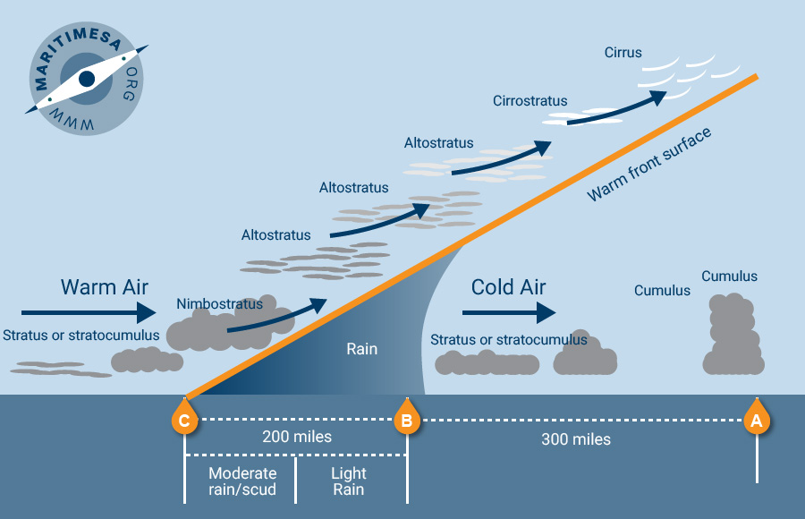
Warm front.
Cold front. When a cold air mass replaces a warmer air mass, a cold front is formed. It is marked by a rise in atmospheric pressure, a fall in temperature and dew point and the wind backs (changes direction in an anti-clockwise direction). Rain usually occurs and may extend some 50 to 100 miles ahead or behind the front. Cold fronts usually produce heavy showers at the front. Thunder may also occur. The average slope is 1:50.
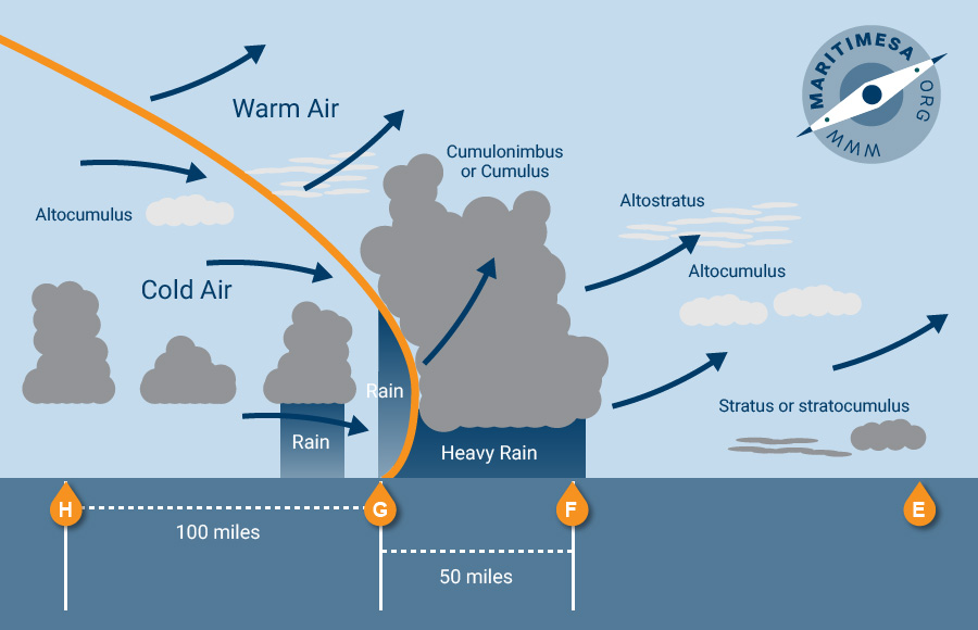
Cold front.