The GMDSS system is made up of five sub-systems as follows:
- DSC (digital selective calling) terrestrial communications system.
Dedicated frequencies are made available for maritime communications operating in the VHF, HF and MF radio bands. This provides long, medium and short-range communications.
Use is made of DSC technology which provides a means of calling a station or group of stations using digital techniques.
The basic idea is to provide an automated calling system for initial contact.
The system allows for the name of the vessel, the nature of the distress and the last recorded position to be displayed or printed on receipt of a distress call.
Distress priority ship to shore calls receive priority over all other traffic and are routed to the nearest rescue coordination centre. - Satellite communications system.
Satellite networks provide a full range of communication services which covers all general communication requirements as well as distress and safety requirements. - Maritime Safety Information system (MSI).
MSI includes all meteorological and navigation warnings, meteorological forecasts and other urgent safety related messages of vital importance to all ships at sea.
The above is broadcast by MF telex (NAVTEX) for local MSI and by satellite or HF telex for long range MSI.
Typical GMDSS communications set up.
- EPIRB system (Emergency Position Indicating Radio Beacon).
EPIRB is done through INMARSAT (geostationary satellite system using L band)) and COSPAS-SARSAT (Polar orbiting satellite system using 406MHz).
Full global coverage is provided by the polar orbiting COSPAS-SARSAT system which uses doppler frequency shift techniques to establish the vessels position.
Some 406MHz EPIRBs have an interface with the ship’s navigation system which enables them to pass their position directly.
The L band EPIRB is connected to the ship’s navigation system and is provided continuously with an updated position. They are mounted on the bridge and on the outside bulkhead of the bridge structure. They can be operated manually or if there is not sufficient time to operate the EPIRB, it is designed to break free of the vessel when it sinks and upon reaching the surface will transmit automatically. INMARSAT does not cover the polar regions.
A 121.5 MHz signal facility is provided on most COSPAS-SARSAT EPIRBs which provides a homing signal for searching aircraft.
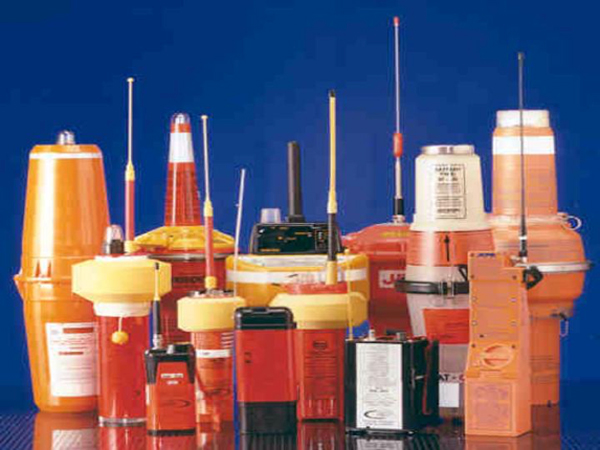
A selection of EPIRB’s.
- Search and rescue transponder system (SART).
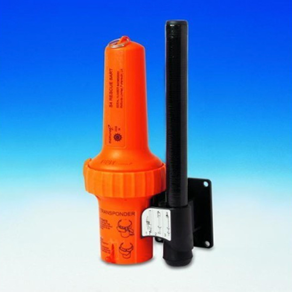
This is a portable radar transponder which is designed to provide a locating signal.
It is designed to be carried in survival craft.
When a 9 GHz radar interrogates the SART, it will provide a signal which will be displayed on the searcher’s radar as a series of twelve dots indicating the course to steer to intercept the transponder.

Example of a SART.


