How do we utilise radar for normal navigation purposes under normal conditions of visibility? There are four basic ways:
- Fix by radar range and visual bearing. This is used when there are few recognisable navigation marks ashore for visual bearings.

Visual bearing and radar range.
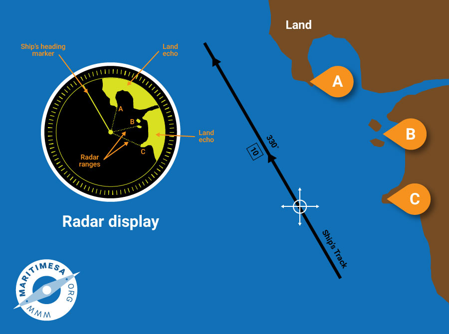
- Fix using radar ranges as position arcs. This is the most accurate method of obtaining a fix using radar only.

Three radar ranges.
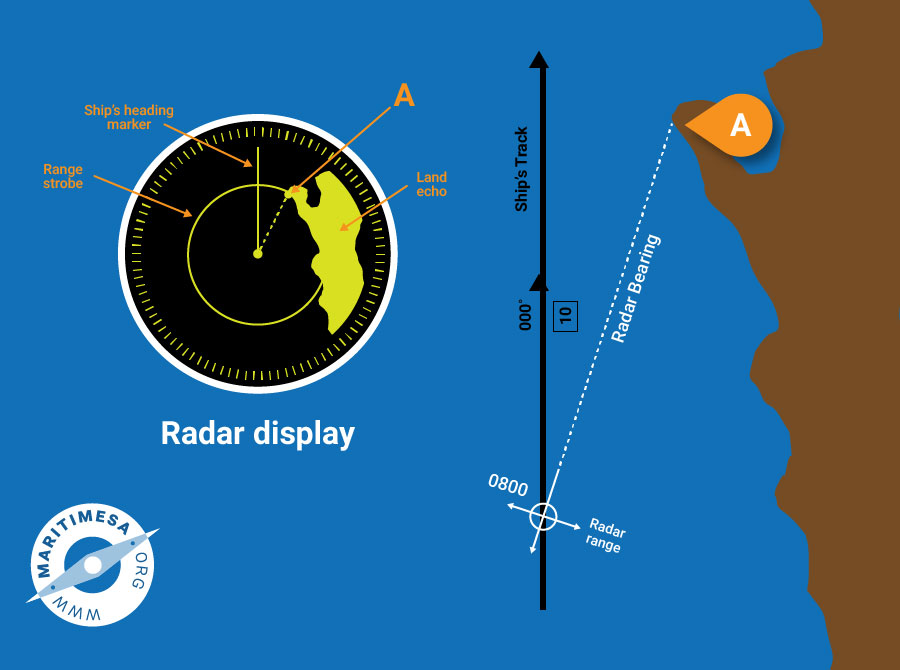
- Fix by using radar range and bearing.This method is used in very poor visibility and there are not many recognisable features on the coast. Because of the beam width of the antenna, the bearing is not very accurate.

Radar bearing and range.
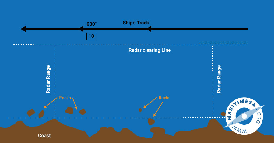
- Use of radar range as a clearing line. This method is used when travelling along a comparatively straight and featureless coast from which accurate fixes may not be obtainable. Usually it is possible to determine a minimum range outside of which no off-lying dangers will be encountered. Occasional ranges of the coastline abeam can be obtained by radar, in order to ensure that the ship is not inside what is in effect, a form of clearing line.

Radar range as a clearing line.


